Several World Record glider flights have been submitted for ratification during 2024. This is now the height of the southern hemisphere soaring season. There may well be more flights to add to the list from southern Africa, Australia and New Zealand.
These are the World Records under review and ratified up to 15 December 2024.
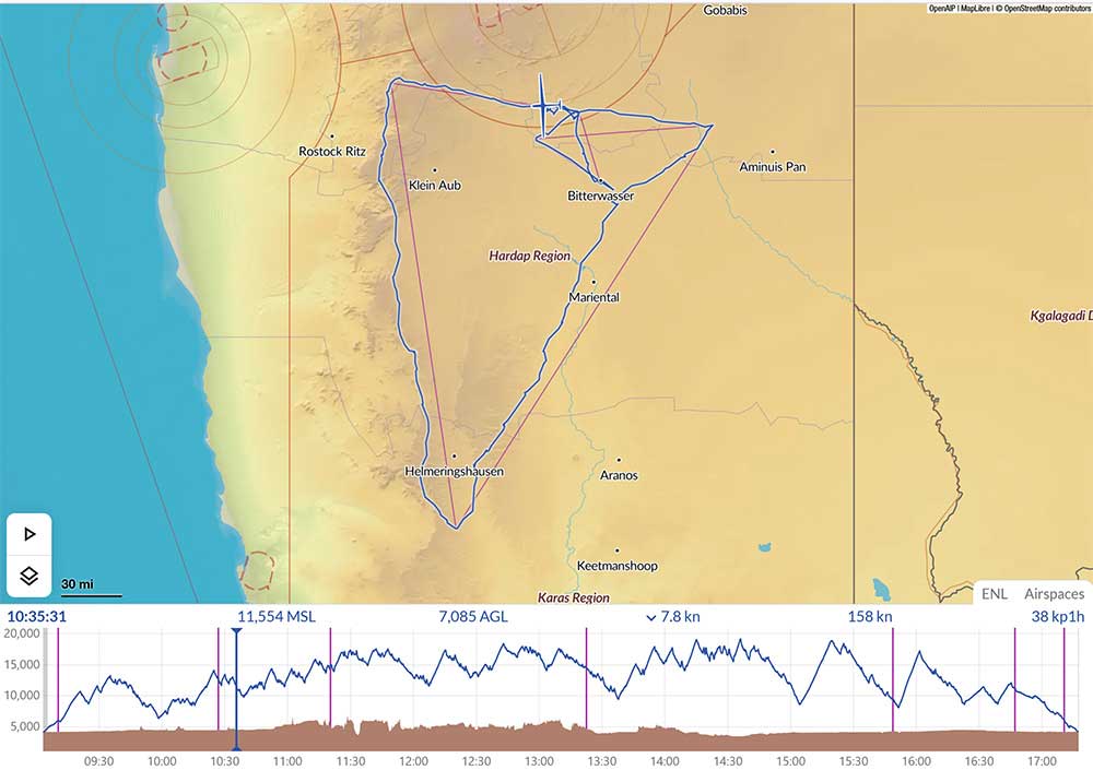
UNDER REVIEW
Uys Jonker (RSA)
African
Open Class Gliders
09 Dec 2024
Speed over a triangular course of 1 000 km
169,33 km/h
Bitterwasser Namibia
JS 3
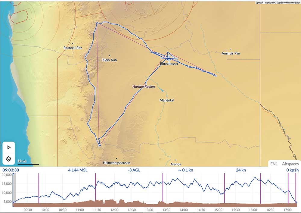
UNDER REVIEW
Katrin Senne (GER)
African – World
Open Class Gliders
Female
09 Dec 2024
Speed over a triangular course of 1 000 km
169,24 km/h
Bitterwasser Namibia
JS 5
World
Speed over a triangular course of 750 km
169,24 km/h
UNDER REVIEW
Steve J. Koerner (USA)
North-American
15m Class
10 Jul 2024
Speed over a triangular course of 1 000 km
151 km/h
Ely, NV (USA)
JS 3
UNDER REVIEW
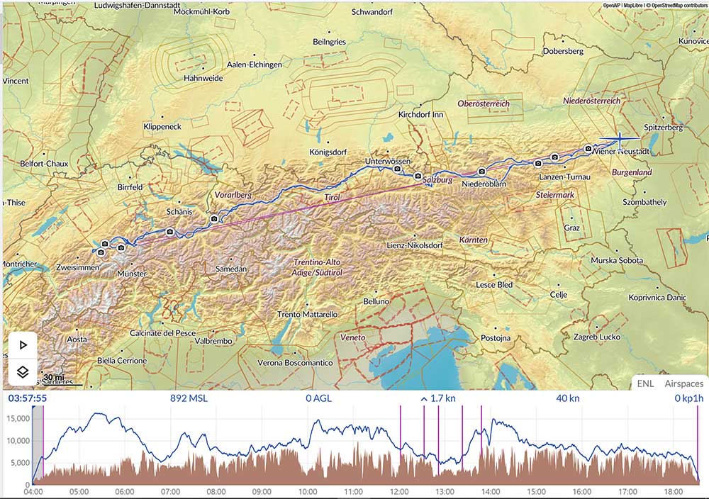
Wolfgang Janowitsch (AUT)
Hermann Trimmel (AUT)
European
Open Class Gliders
30 Apr 2024
Out-and-return distance
1 301,00 km
Wiener Neustadt (Austria)
Arcus M
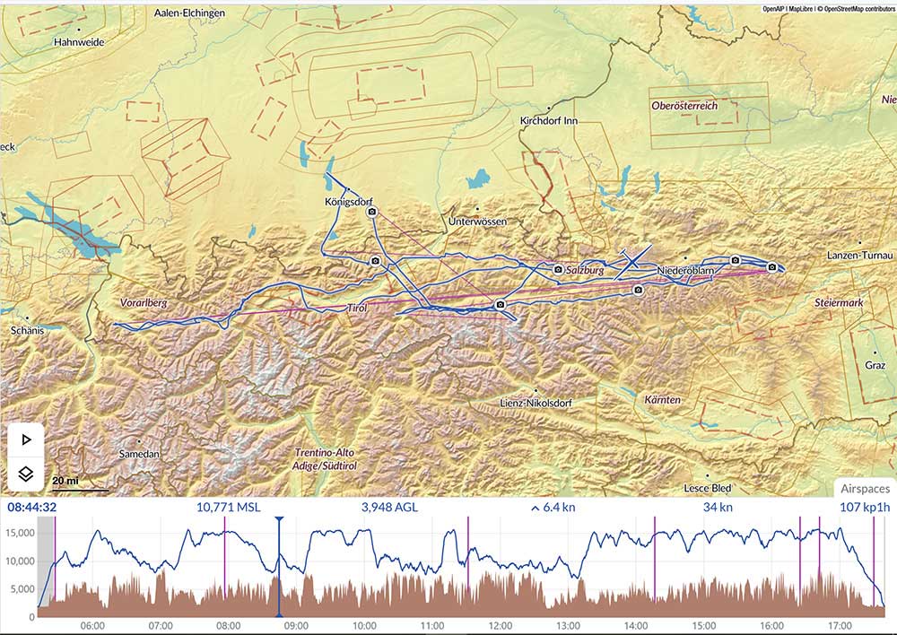
No problems in wave level to the Ennstal, then in the slope wind. First low point near St. Johann in Pongau, just managed to get away with the onset of thermals. From there on the slope to the Rätikon wave, at high level until just before Disentis. There we had to jump north due to overcast clouds, where we fell out of wave level due to the maximum altitude clearance at FL130. After turning around, we spent an hour and a half tinkering at 1,500m above sea level at Meiringen airfield. The flight home was then problem-free again thanks to better altitude clearances, only the schedule was a bit tight. Great flight including an emotional rollercoaster.

Baptiste Innocent (R) and Gil-Souviron
UNRED REVIEW
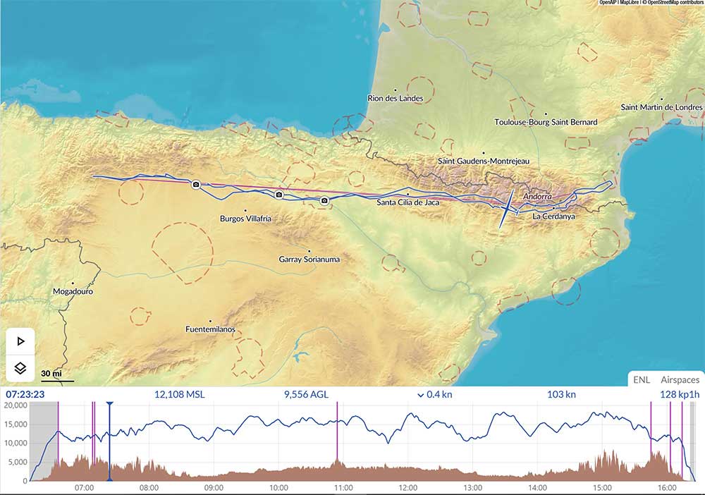
Baptiste Innocent (FRA)
Gil-Souviron (FRA)
European
Open Class Gliders
Date 27 Feb 2024
Speed over an out-and-return course of 1 000 km
134,2 km/h
Out-and-return distance
1 267,8 km
Free distance using up to 3 turn points
1 295,3 km
Perpignan (France)
Stemme S12
UNRED REVIEW
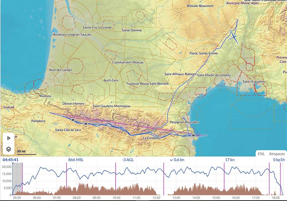
Free distance using up to 3 turn points
10 Apr 2024
1 655,8 km
Aubenas (France)
UNRED REVIEW
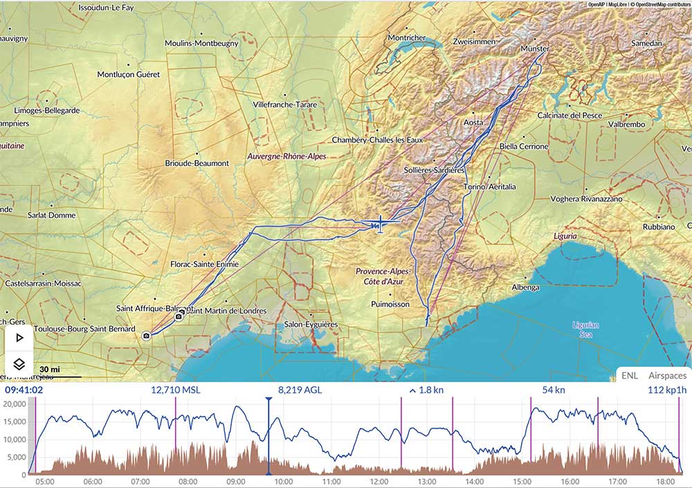
Free distance using up to 3 turn points
16 Apr 2024
1 710,1 km
Fayence (France)
ASH31 Mi 21m
RATIFIED
Benjamin Bachmaier (GER)
European
15m Class Gliders
30 March 2024
Free distance using up to 3 turn points 1 295,3 km
Koenigsdorf (Germany)
Ventus 2 BX
Free distance using up to 3 turn points
1 295,3 km
Distance using up to 3 turn points
1275,7 km
You can see all International Gliding Records at
- Details
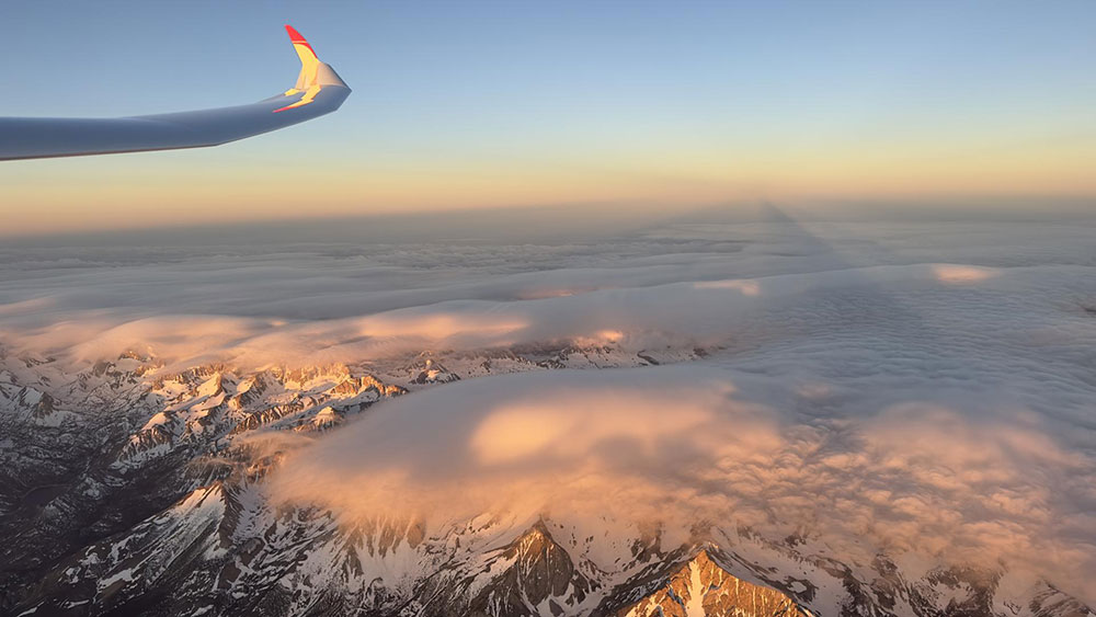
On 19 June 2023 Gordon Boettger & Bruce Campbell flew a 3,058km from Minden-Tahoe Nevada USA. Using night vision goggles the pair launched in the dark and spent the next 17 hours 40 minutes traversing the Sierra Nevada in wave. Here is their story told by Gordon.
The plan was to takeoff sometime after midnight and make a cross country through most of the night and practice with the NVGs and see how cold it would be at high altitude at night. The forecast was for good wave throughout the night and getting very weak by 1400L back in the Minden area.
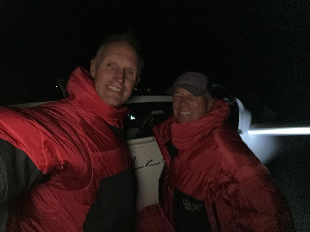
My expectations were low. I asked my copilot if he was interested in joining me. Takeoff was at 02:30L (Lima Time Zone - UTC +11) in windy conditions on a very dark night with night vision goggles (NVG). I had a normal climb in blue wave and got my IFR clearance and went south using the NVGs. It was absolutely magical and I felt like I was in an IMAX movie as we watched the Milky Way and shooting stars continuously through the NVGs.
UNFORGETTABLE
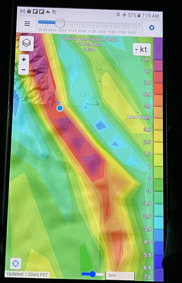
Skysight showed good wave in the Owens Valley to the south. The difficulty with the wave in our area is that normally the energy runs out to the south near Inyokern along the southern end of the Sierra and to the north near Susanville there is too much moisture and the wave weakens. In Argentina it is possible to fly much further to the south and north than along the Sierra.
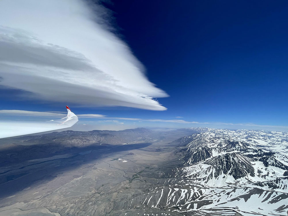
When arriving in the Joshua military airspace I was told to descend below FL180 before entering the airspace because the Joshua controllers did not open the airspace until 0500L. That was a surprise. When they arrived at 05:00L I was able to get my clearance in the military airspace and climb into the flight levels. The wave was blue the entire day with the exception of the Owens Valley which had a lenticular and a few small rotor clouds.
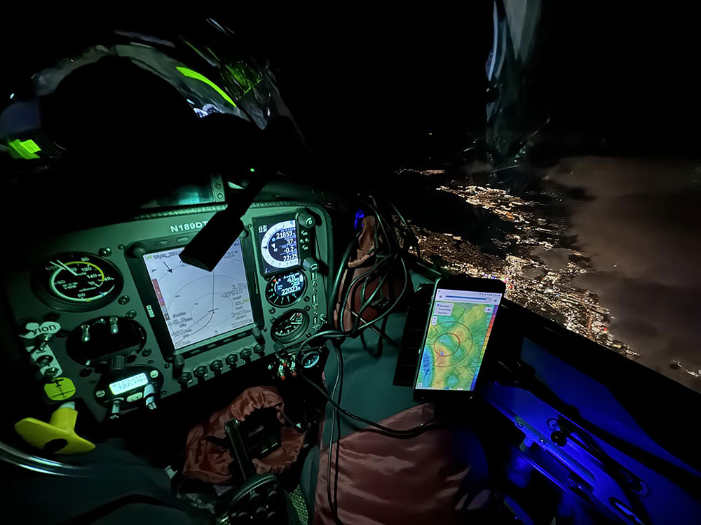
The first turn was made near Inyokern in the south when the wave got very weak. The second leg was not a problem as the sun came up and the NVGs came off. I made my second turn point NW of Reno when the wave became very weak. I wanted to fly further to the north near Susanville but there was too much cloud cover and there was no visible sign of wave. I turned south again and remained on my IFR clearance.
ATC was SUPERB and a great help. The workload is extremely high at times coordinating with ATC. The 3rd leg to the south was not a problem. I realized during these legs that the wave was not too strong and that I had flown most flights in much stronger conditions. I made my 3rd turn point again near Inyokern. Another run now to the north with not much difficulty. At this point we started calculating what was possible. 2500km seemed like a guarantee and then the discussion of 3000km came up.
We both realized that my final leg to the north would have to go way beyond Susanville. The difference between 2500 and 3000km is big and much more difficult. In my mind I thought it would not be possible since there was no wave forecast and far too much moisture north of Susanville for the last few hundred kilometers. The fourth turn was once again made in the Reno area. On my last leg to the south I tried to extend south of Inyokern but Skysight showed too weak and it did not feel like we could maintain altitude (when flying in the Sierra wave in the Owens Valley, getting below 15000' means you're getting pretty low.
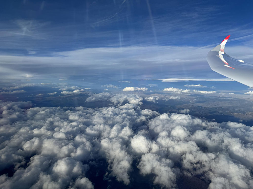
Because the mountains are so high there, one can experience severe rotor at 16000' and you can be on the ground very quickly, so one must be more conservative there). My last turn point was further north than I liked which meant we had to fly much further north on my last leg into the airmass that had no wave and too much cloud cover. The flight became intense now as I realized it would take all of my concentration and some luck. This is already on a very fatigued mind. When I arrived in the Reno area, I slowed down and flew very conservative. I climbed to my maximum allowed altitude of FL230 and we did some major planning. We determined that Alturas would safely get us beyond 3020 km. The weather there said there were several layers of cloud and an overcast layer. I made my turn toward Alturas looking at solid cloud cover ahead. Knowing I had to descend below a solid cloud cover I headed in the direction of Alturas. I had final glide made but by not much.
As I neared the cloud layer I pushed the nose over and got underneath with maybe 100 km to go. I was maneuvering around snow showers and due to the cloud cover the forward visibility was difficult in the direction of Alturas but I did see some sun on the ground ahead. As I got into the sunny area I could see better and made a left turn toward Alturas. As I arrived about 60 km from Alturas airport I was surrounded by solid clouds ahead all around me. There were snow showers and very dark clouds almost to the ground in the direction of Alturas. My OLC distance on the LX read 2988km. I couldn't believe it. My dream of 3000km was smashed because of the clouds. I turned around and flew south for a bit around clouds and then east above high ground on the south end of the mountain range.
I had Cedarville airport as a backup in the computer but was below glide. Because of the cloud cover and my low altitude I had to continue east in order to get around the mountain range west of Cedarville. I flew very carefully and cleared the ridge and flew to a rotor that I circled under to gain lift. I still had 50km to Cedarville and my OLC distance still said 2988km. Although the clouds in the sky showed no sign of lift, I found lift under a rotor cu that eventually got me high enough to get into laminar wave. I now had Cedarville airport within glide as I flew northbound to Cedarville. The excitement was crazy since I now knew I would accomplish what I never thought I could do this day. We flew over the airport and continued north for a while until the cloud cover and snow showers prevented us from going further. I turned south and flew back to Cedarville airport where we landed after flying 3058km and 17h40min.
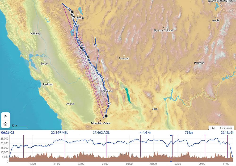
UNBELIEVABLE FEELING
First I must thank Matthew Scutter with SKYSIGHT for providing such an incredible product that was a massive help in accomplishing this flight. Thanks to my partner in the Arcus, Bruce for joining me in this wild adventure. Bruce has never flown with NVGs before this flight. Thanks to Tim Gardner for all his help and retrieve the next morning with the Cessna. Thanks Bob Trumbly for helping get our glider back home. Thanks to my wife for letting me do this crazy stuff. Thanks to all the Air Traffic controllers that worked with us and were so very patient and helpful. Thank you for all of the people that followed the flight and provided encouragement and wonderful comments. WE ARE A TEAM and that's what it takes to achieve these goals.
- Details

